- Home
-
Projects

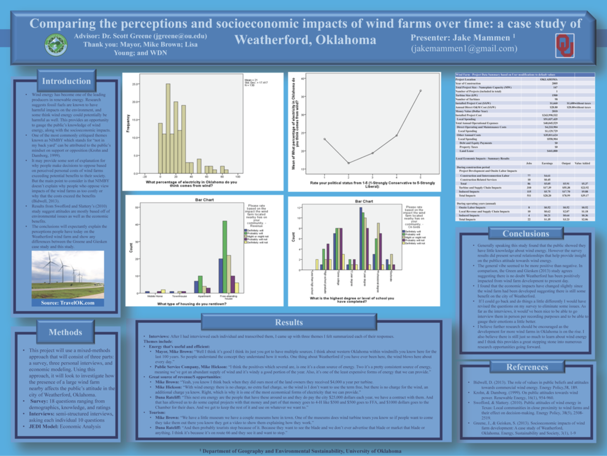
 Wind Farm Case Study - 2019Perceptions and socioeconmic impacts of wind farms
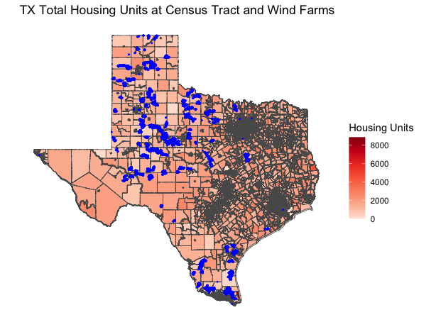
 Influence on the Development of Wind FarmsSocioeconomic and Environmental influence on development of new wind farms
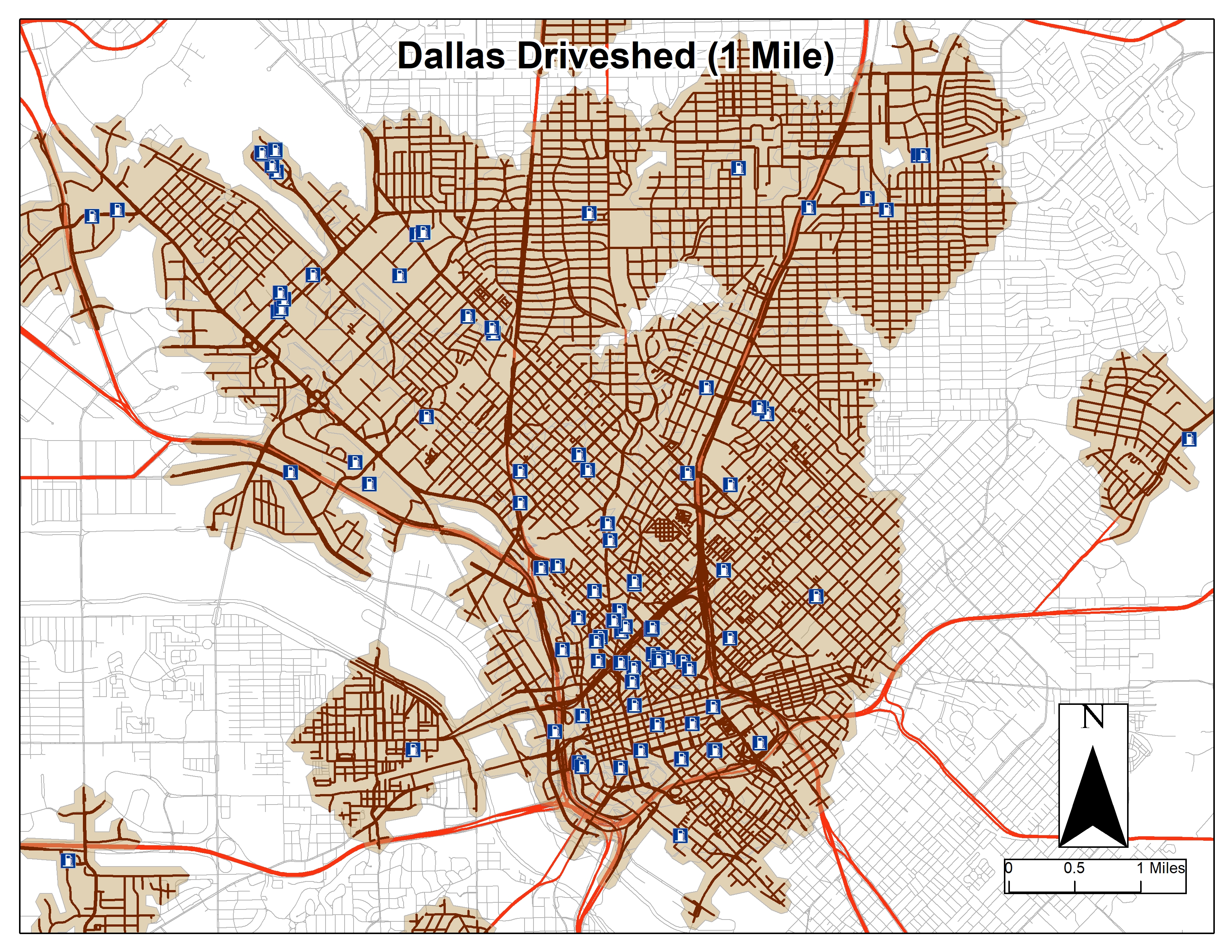
 EV Infrastructure AnalysisAnalysis of EV infrastructure in DFW
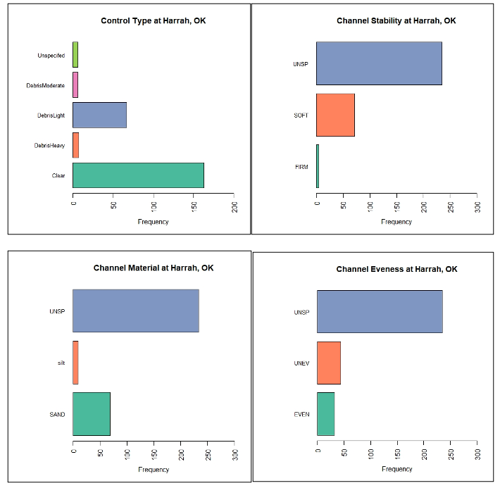
 Statistical Analysis of Streamflow DataA Statistical Analysis of Streamflow Data in Oklahoma
 - Blog
- About
- Contact